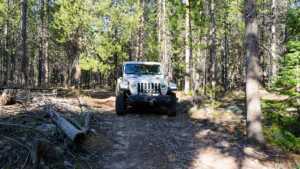
Alexander Loop & Spur is a short forest route in the Soapstone Basin area of the Uinta-Wasatch-Cache National Forest, east of Kamas, Utah. The route covers just under two miles of two-track at around 9,000 feet, dropping off a rocky, open hillside at the north end and settling into dense lodgepole pine for the rest of the run. A marker post for route 940 stands near the north end. The main draw is dispersed camping, with a pine-sheltered site along the way that holds two to three rigs, four in a pinch. It makes a quick side trip off the Soapstone Basin network or a way to find a quieter campsite away from the main road.
Trail Summary
- Location: Soapstone Basin area, Uinta-Wasatch-Cache National Forest. Closest city is Kamas, Utah. Access is from the Mirror Lake Highway (SR-150) and Soapstone Basin Road junction.
- Distance: 1.9 miles
- Difficulty: Level 3
- Minimum Elevation: 8,999 feet
- Maximum Elevation: 9,159 feet
- Elevation Gain: 128 feet gain, 149 feet loss
- Travel Time: 20 to 30 minutes
Difficulty
Best suited for a high clearance 4x4
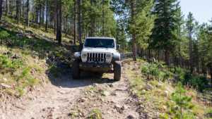
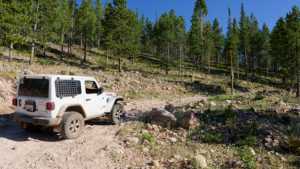
Stock vehicles with high ground clearance, 4WD capability, and off-road tires will handle this route. The rocky descent at the north end has embedded rock, ruts, and loose surface material with obstacles under 12 inches, and careful tire placement helps on the steeper pitches. The road is one vehicle wide through the trees with places to pass.
Elevation
The route stays between 8,999 and 9,159 feet. From the north end it loses elevation down the open hillside, then rolls gently through the forest with 128 feet of total gain and 149 feet of loss over the full run. Net change end to end is minimal.
Terrain
The north end is rocky two-track crossing an open, sparsely treed slope with embedded rock and loose surface material. Once the route enters the lodgepole stands, the surface changes to packed dirt with scattered roots and cut deadfall along the edges. The road is narrow through the timber, and clearings break up the forest in a few spots along the southern half.
4WD Experience
A high clearance 4x4 is the right vehicle for this route. The rocky hillside at the north end is the section that earns the rating, with embedded rock and loose material that calls for deliberate tire placement, especially in a wider rig. The forest sections drive easily in dry conditions, but after rain the dirt holds water and gets slick, and the route is not maintained for wet weather travel. Full-size vehicles fit, though the tree corridor is tight in places.
Travel Time
The route drives in about 20 minutes at a steady pace. Plan on 30 minutes or more if you stop to check out the camping area and clearings along the way.
Highlights
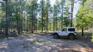
The pine-sheltered camping area partway down the route is the main feature, with room for two to three rigs and space for a fourth. The first clearing south of the camp opens up the forest after a long stretch of driving through the pines. The open hillside at the north end gives a brief look across the surrounding timber before the route drops into the trees.
Map
Interesting Waypoints
Waypoint 1
Waypoint 2

Waypoint 3 (40.606936, -110.988288) (GPS Location estimated from timestamp)

Waypoint 4 (40.606928, -110.98829) (GPS Location estimated from timestamp)
Waypoint 5 (40.606909, -110.988296) (GPS Location estimated from timestamp)

Waypoint 6 (40.602908, -110.993431) (GPS Location estimated from timestamp)
Waypoint 7 (40.60293, -110.993405) (GPS Location estimated from timestamp)

Waypoint 8 (40.601598, -110.99413) (GPS Location estimated from timestamp)

Waypoint 9 (40.601539, -110.994204) (GPS Location estimated from timestamp)