Cedar Hollow climbs out of a pine and aspen forest above Woodland, Utah, gaining more than a thousand feet over three and a half miles on its way to an open meadow in the Uinta-Wasatch-Cache National Forest. The road is well used and well maintained, with several dry camp spots along the lower half and a couple of sharp switchbacks partway up. It is a straightforward drive for a high clearance vehicle, with just enough rock and rut to keep things interesting.
Trail Summary
- Location: Near Woodland, Utah, off State Route 35 (Wolf Creek Pass Highway) at Forest Road 80202, Uinta-Wasatch-Cache National Forest
- Distance: 3.5 miles one way
- Difficulty: Level 2 - Typically suitable for high clearance 2WD
- Minimum Elevation: 6,973 feet
- Maximum Elevation: 8,215 feet
- Elevation Gain: 1,230 feet
- Travel Time: About 35 to 40 minutes
Difficulty
Typically suitable for high clearance 2WD
Stock equipment is sufficient here, but the climb will test tire traction and ground clearance in a few spots. The road surface is dirt and rock with ruts and erosion in places, along with some small embedded rock shelves. Two switchbacks partway up are steep but hold good traction. The road narrows through the trees in a few sections, so larger trucks and anything towed should be left at the meadow below.
Elevation
The trail starts at 6,973 feet and climbs steadily to 8,215 feet at the high meadow, a gain of 1,230 feet over 3.5 miles. There is almost no descent along the way. The grade is moderate and consistent through the lower forest, then tightens up through the switchbacks before easing off near the top.
Terrain
Cedar Hollow runs as a narrow shelf road through dense pine and aspen, opening into meadows near the top. Expect a rutted, rocky surface with erosion in spots and a few small embedded rock ledges. The road is mostly one vehicle wide with occasional pullouts, and tree branches close in tight enough in places to leave pinstripes on wider rigs.
4WD Experience
A stock high clearance vehicle with 6 to 8 inches of clearance handles this trail without much trouble. The two switchbacks are sharp but manageable for trucks, SUVs, and smaller vehicles with careful line choice. The ruts and embedded rock get more noticeable toward the upper half, where careful tire placement helps avoid a scrape. Four wheel drive is not strictly required in dry conditions but is a good idea given the erosion and loose rock higher up.
Travel Time
The drive up takes about 35 to 40 minutes at a relaxed pace with stops for photos and the view from the switchback. Add extra time if towing anything or exploring the campsites and side spurs along the way.
Highlights
The lower trail has several roomy campsites shaded by pines, including one large enough for two or three big rigs. A junction near the meadow has an information board and pit toilets, where the Aspen Pass ATV trail connects in. The switchback near the top opens to a wide view across the valley and surrounding ranges. The trail ends at a three way junction in the high meadow, with several other routes to continue exploring from there.
Photos
Photo 1 (GPS Location estimated from timestamp: 40.55620, -111.16259)
Staging area at the start of the trail.
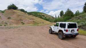
Photo 2 (GPS Location estimated from timestamp: 40.55874, -111.15625)
One of the large campsites along the lower trail.

Photo 3 (GPS Location estimated from timestamp: 40.55874, -111.15625)
Another view of the same campsite area.
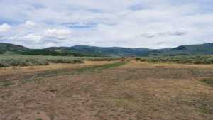
Photo 4 (GPS Location estimated from timestamp: 40.56344, -111.15162)
Trail junction with the information board and pit toilets.
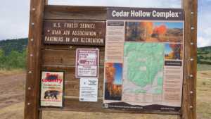
Photo 5 (GPS Location estimated from timestamp: 40.57404, -111.14435)
The scenic view at the top of the switchback.

Photo 6 (GPS Location estimated from timestamp: 40.57397, -111.14423)
Another look at the switchback viewpoint.
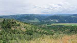
Photo 7 (GPS Location estimated from timestamp: 40.57553, -111.14523)
Approaching the most technical section of the trail.

Photo 8 (GPS Location estimated from timestamp: 40.57557, -111.14524)
The trail's most technical stretch.
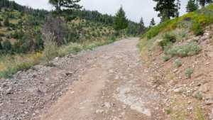
Photo 9 (GPS Location estimated from timestamp: 40.58941, -111.14615)
Nearing the end of the trail in the high meadow.
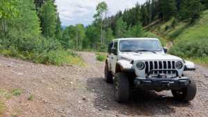
Photo 10 (GPS Location estimated from timestamp: 40.58942, -111.14615)
The trail's end point, where it splits into three routes.
