Hogs Back Road climbs east out of the Center Creek area southeast of Heber City, working its way through aspen groves and open meadow before topping out near Tower Mountain in the western Uinta Mountains. The route runs mostly one vehicle wide with regular pullouts, gaining better than 2,000 feet from start to the high point along the way. A short, optional spur partway through leads to a view of Center Creek Number 5 Reservoir, and the trail wraps up with a wide-open look back over the Uintas from the shoulder of Tower Mountain.
Trail Summary
- Location: Wasatch County, Utah, near Daniel and Center Creek, accessed off Center Creek Road (FR 70309) southeast of Heber City
- Distance: 8.3 miles, point to point
- Difficulty: Level 3 - Best suited for a high clearance 4x4
- Minimum Elevation: 8,566 feet
- Maximum Elevation: 10,172 feet
- Elevation Gain: 2,265 feet
- Travel Time: About 1 hour 40 minutes on the recorded run, 2 to 2.5 hours with stops
Difficulty
Best suited for a high clearance 4x4
Stock vehicles with high ground clearance, 4WD capability, and off-road tires are the baseline here. Expect more rock and undulated surface than a beginner route, with occasional ledges, dips, or short climbs under 12 inches. Careful tire placement helps in a few spots, and the road can get steep or loose in short stretches. The surface is uneven and rutted in places, with loose rock, sandy patches, and the potential for mud holes after wet weather. Most of the route runs one vehicle wide with places to pass.
Elevation
The trailhead near Center Creek Road sits around 8,566 feet. From there the road climbs steadily with a few dips along the way, gaining roughly 2,265 feet and losing about 1,034 feet over the course of the run, for a net gain of around 1,232 feet by the time it reaches its high point near Tower Mountain at 10,172 feet. The steepest sustained climbing comes in the final third of the trail, working up toward the summit view.
Terrain
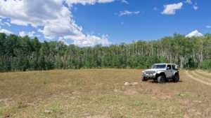
This is mountain shelf road and rocky two-track for most of its length. The first couple miles run through aspen stands and thick brush close enough to the road to pinstripe a rig, opening into rolling grass and timber country through the middle section. The final climb toward Tower Mountain tightens back up into a rockier, more exposed shelf road with good views opening up as the elevation builds.
4WD Experience
Stock high-clearance 4x4s with a good set of all-terrain or mud-terrain tires handle this trail without much drama. The toughest section sits roughly a third of the way in, rated at the top of this trail's difficulty range, where loose rock and a rutted surface call for more deliberate tire placement. The rest of the route is a steady, moderate two-track with occasional rough patches but nothing that should surprise a stock 4x4 driver paying attention.
Travel Time
The recorded run covered the full out and back distance in about 1 hour 40 minutes, including stops. A high-clearance 4WD driver covering the same ground at a relaxed pace, with time to check out the old corral, the cabin, the reservoir overlook spur, and the summit view near Tower Mountain, should plan on 2 to 2.5 hours.
Highlights
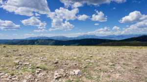
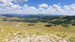
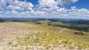
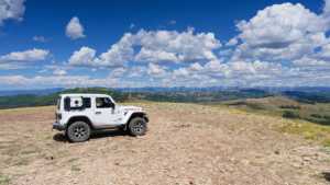
A clear view of Mount Timpanogos opens up early in the drive. Farther along, an old split-rail corral sits just off the road, with part of the fence line still standing. A small log cabin, likely built for hunters, appears partway through the rolling meadow section. An optional spur leads to a view of Center Creek Number 5 Reservoir, though the reservoir itself sits on private property and is best appreciated from a distance. The trail finishes with a wide, sweeping view over the western Uinta Mountains from the shoulder of Tower Mountain, a worthwhile detour for anyone running the full route.
Map
Interesting Waypoints
Waypoint 1 (40.415494, -111.276222)

Waypoint 2 (40.415494, -111.276219)

Waypoint 3 (40.412326, -111.267635)

Waypoint 4 (40.412321, -111.26762)

Waypoint 5 (40.41156, -111.265878)

Waypoint 6 (40.411568, -111.265394)

Waypoint 7 (40.411571, -111.265393)

Waypoint 8 (40.411571, -111.265392)

Waypoint 9 (40.411173, -111.261055)

Waypoint 10 (40.411174, -111.261059)
Waypoint 11 (40.411175, -111.26106)

Waypoint 12 (40.411527, -111.257182)

Waypoint 13 (40.411525, -111.257161)

Waypoint 14 (40.41016, -111.253257)

Waypoint 15 (40.40747, -111.249861)

Waypoint 16 (40.407441, -111.249722)

Waypoint 17 (40.40678, -111.246981)

Waypoint 18 (40.406711, -111.246905)

Waypoint 19 (40.40671, -111.246903)

Waypoint 20 (40.407973, -111.243137)

Waypoint 21 (40.420541, -111.234748)

Waypoint 22 (40.420679, -111.234521)

Waypoint 23 (40.404542, -111.186528)
Waypoint 24 (40.404425, -111.186365)

Waypoint 25 (40.404426, -111.186364)

Waypoint 26 (40.404426, -111.186363)
Waypoint 27 (40.404426, -111.186363)
Waypoint 28 (40.404427, -111.186361)
Waypoint 29 (40.404427, -111.18636)

Waypoint 30 (40.414171, -111.177878)

Waypoint 31 (40.414172, -111.177877)

Waypoint 32 (40.414187, -111.177863)
