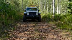
Jones Hollow drops out of the high timber above Soapstone Basin and follows an old forest road down through aspen groves and open meadow to the lower drainage near Strawberry Reservoir. The route loses nearly 1,500 feet over its length, giving drivers a steady descent with sweeping views of the Wasatch back country before the trail settles into a quieter valley bottom.
Trail Summary
- Location: Wasatch County, Utah, in the Soapstone Basin area near Strawberry Reservoir. Closest city: Heber City. Closest major road intersection: US-40 and UT-35 near Daniels Summit.
- Distance: 3.7 miles
- Difficulty: Level 2
- Minimum Elevation: 7,841 ft
- Maximum Elevation: 9,345 ft
- Elevation Gain: 90 ft
- Travel Time: 45 minutes to an hour
Difficulty
Typically suitable for high clearance 2WD
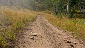
Stock equipment is sufficient, but the terrain will likely test tire traction and ground clearance in a few spots. Expect dirt and rocky road surface with occasional obstacles under 9 inches, such as rocks, dips, or ruts. Grades can be steep in places but traction stays good through most of the drive.
Elevation
The trail starts near 9,345 feet at the top of Soapstone Basin and works its way down to about 7,841 feet by the end. Nearly all of that change comes as loss, with the road losing roughly 1,586 feet over 3.7 miles and gaining back only about 90 feet along the way. The descent is steady rather than abrupt, so the elevation change is felt more as a long, gradual drop than a series of sharp climbs and dips.
Terrain
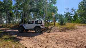
Jones Hollow runs through mountain shelf road and rocky two-track, threading through stands of aspen and conifer before opening into grassy meadow lower down. The road surface is dirt and loose rock, generally one vehicle wide with occasional pullouts to let oncoming traffic pass. A few tighter turns and minor ruts keep the drive interesting without demanding much from the vehicle.
4WD Experience
This is a comfortable route for a high clearance 4WD, and most stock SUVs and trucks will handle it without issue. The main things to watch for are loose rock on the steeper pitches and the occasional rut left behind from spring runoff. Four wheel drive helps with traction on the looser sections, but low range shouldn't be necessary in dry conditions.
Travel Time
Plan on 45 minutes to an hour behind the wheel, more if you stop to take in the views or work through any standing water after a wet spring. The trail records at around 36 minutes of moving time, but that pace assumes no stops and dry, established conditions.
Highlights
The upper stretch offers wide views back across Soapstone Basin, and the aspen stands along the middle of the route put on a good show in the fall. As the trail drops toward Strawberry Reservoir, the terrain opens into meadow with a noticeably different feel from the timber above, a nice contrast for a relatively short drive.
Map
Interesting Waypoints
Waypoint 1 (40.237018, -111.267788)

Interesting Waypoints
Waypoint 2 (40.236939, -111.267749)

Interesting Waypoints
Waypoint 3 (40.236938, -111.267750)
Interesting Waypoints
Waypoint 4 (40.236767, -111.262117)
Interesting Waypoints
Waypoint 5 (40.236558, -111.261331)

Interesting Waypoints
Waypoint 6 (40.251845, -111.231912)

Interesting Waypoints
Waypoint 7 (40.252038, -111.231850)

Interesting Waypoints
Waypoint 8 (40.252246, -111.231731)

Interesting Waypoints
Waypoint 9 (40.255913, -111.230598)

Interesting Waypoints
Waypoint 10 (40.255965, -111.230570)

Interesting Waypoints
Waypoint 11 (40.255982, -111.230561)

Interesting Waypoints
Waypoint 12

Interesting Waypoints
Waypoint 13