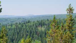
Lambert Burn Road, also logged locally as Trail 287, branches off Soapstone Basin Road in the Uinta National Forest east of Kamas. The route climbs gradually through open camping flats and aspen groves before dead-ending at a fence line marking the edge of motorized travel. It is a short out-and-back drive, well suited to an afternoon exploring campsites and testing a rig on a handful of mild obstacles.
Trail Summary
- Location: Uinta National Forest, near Kamas, Utah
- Distance: 1.4 miles (one way)
- Difficulty: Level 2
- Minimum Elevation: 8,865 ft
- Maximum Elevation: 9,154 ft
- Elevation Gain: 232 ft
- Travel Time: 20 to 30 minutes
Difficulty
Typically suitable for high clearance 2WD
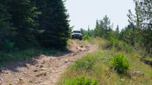
Stock equipment is sufficient, but terrain will likely test tire traction and ground clearance. Expect dirt and rocky road surface with potential obstacles less than 9 inches, including rocks, dips, and ruts. Grades can be steep in short sections but traction is generally good. Roads are typically one to two vehicles wide, and unmaintained stretches after rain or snow can add shallow water crossings and small ledges up to 12 inches.
Elevation
The road holds a narrow elevation band, climbing from 8,865 feet at the low point near the junction with Soapstone Basin Road to 9,154 feet at the fence line where the trail ends. Total gain over the run is 232 feet, with about 53 feet of loss worked in along the way, for a net change of roughly 179 feet. Nothing on this route feels like sustained climbing, more a gentle rise and fall as the road works through the trees.
Terrain
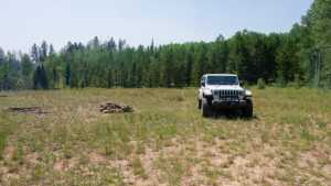
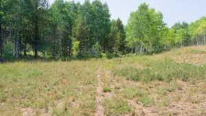
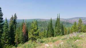
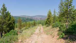
This is foothill terrain typical of the lower Uintas, dirt and rocky two-track winding through stands of aspen and pine. The road opens into several broad, sunny flats used for camping, then narrows again as it threads through the trees. A well worn game trail crosses one of the camp areas, a reminder that wildlife uses this ground as much as vehicles do.
4WD Experience
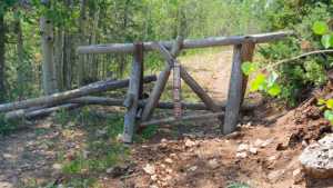
Most of Lambert Burn Road is a straightforward dirt drive that a high clearance 2WD could manage in dry conditions. The most demanding section comes early, roughly a third of a mile in, where the road narrows and tire placement matters more than anywhere else on the route. Beyond that, the trail settles into an easy cruise past the camping flats until it reaches the fence line and a clearly posted end to motorized travel.
Travel Time
The one way run covers 1.4 miles and takes most drivers 20 to 30 minutes at a relaxed pace, longer if you stop to check out the camp spots or let a group spread out. There is no reason to rush this one. It is short enough to pair with other trails off Soapstone Basin Road in the same outing.
Highlights
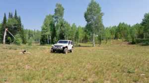
Three separate camping flats sit along the route, each large enough to host multiple rigs, though none offer much shade. Aspen groves mix with pine through the middle section of the drive, and the road ends at a fence with a clear no motor vehicles marking, a good spot to park, stretch, and turn around.
Map
Interesting Waypoints
Waypoint 1 (40.5491, -111.0011)

Waypoint 2 (40.5491, -111.0010)

Waypoint 3 (40.5491, -111.0010)
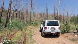
Waypoint 4 (40.5491, -111.0010)
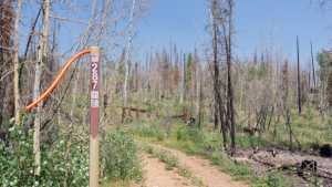
Waypoint 5 (40.5502, -111.0016)

Waypoint 6 (40.5511, -111.0066)

Waypoint 7 (40.5511, -111.0066)
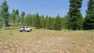
Waypoint 8 (40.5511, -111.0065)
Waypoint 9 (40.5500, -111.0138)

Waypoint 10 (40.5500, -111.0138)

Waypoint 11 (40.5477, -111.0178)

Waypoint 12 (40.5477, -111.0179)
Waypoint 13 (40.5477, -111.0179)
Waypoint 14 (40.5472, -111.0181)
Waypoint 15 (40.5471, -111.0182)

Waypoint 16 (40.5471, -111.0182)

Waypoint 17
Waypoint 18
Waypoint 19
Waypoint 20

Waypoint 21