Piuta Road cuts through Soapstone Basin in the Uinta-Wasatch-Cache National Forest, linking the Piuta Camp area to a high shelf overlooking the Duchesne River drainage. The route is short but varied, opening at a wide dispersed camping flat before climbing onto a rutted bench with a short optional bypass, then rolling out to viewpoints over Mount Timpanogos, Woodland, and Jordanelle Reservoir before ending at a spacious turnaround.
Trail Summary
- Location: Soapstone Basin, Uinta-Wasatch-Cache National Forest, near Woodland, Utah
- Distance: 2.15 miles
- Difficulty: Level 2 (Level 3 optional on unbypassed section)
- Minimum Elevation: 8,980 ft
- Maximum Elevation: 9,232 ft
- Elevation Gain: 163 ft
- Travel Time: 45 minutes to 1 hour
Difficulty
Typically suitable for high clearance 2WD
Stock equipment is sufficient, but terrain will likely test tire traction and ground clearance. Expect dirt and rocky road with obstacles under 9 inches, such as rocks, dips, and ruts. One section of the trail is rutted enough to push toward a Level 3 rating, but a marked bypass keeps it at Level 1 for those who prefer to skip it.
Elevation
The trail holds a narrow elevation band, running from 8,980 feet near the western end to 9,232 feet at its high point. Total gain comes to 163 feet with 179 feet of loss, for a net drop of about 17 feet from start to finish. There are no sustained climbs, just gentle rolling grades typical of a forest bench road.
Terrain
Piuta Road runs as mountain shelf road and rocky two-track through mixed conifer and aspen stands. The surface is packed dirt with scattered rock and a rutted stretch partway through the route. The road stays mostly one to two vehicles wide, with a large open flat near the start that works well for camping or staging.
4WD Experience
This is a mellow, scenic drive that still asks for some attention. Right after the trailhead, the road splits into multiple spurs; stay right to follow the main line. The rutted section, roughly a third of the way in, is the trail's main obstacle. It can be run direct for a Level 2 to 3 challenge or skipped entirely on the marked bypass, which keeps things at Level 1. Beyond that, the road settles into easy rolling travel with wide sightlines through the trees.
Travel Time
Recorded travel time for this run came to about 46 minutes covering 2.15 miles, with roughly 30 minutes of that in motion. For a high clearance 4WD vehicle taking time to enjoy the viewpoints, plan on 45 minutes to an hour end to end.
Highlights
The standout stretch comes in the trail's second half, where the road opens up to long views of Mount Timpanogos, a well known landmark across the region, along with Woodland and Jordanelle Reservoir spread out below. The trail wraps up at a generous turnaround with enough room for five or six rigs, making it an easy spot to regroup before heading back out.
Map
Photos
Photo 1 (GPS Location estimated from timestamp)

Photo 2 (GPS Location estimated from timestamp)

Photo 3 (GPS Location estimated from timestamp)
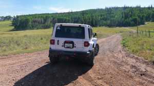
Photo 4 (GPS Location estimated from timestamp)
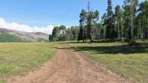
Photo 5 (GPS Location estimated from timestamp)
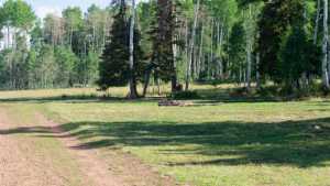
Photo 6 (GPS Location estimated from timestamp)

Photo 7 (GPS Location estimated from timestamp)
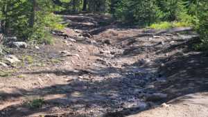
Photo 8 (GPS Location estimated from timestamp)

Photo 9 (GPS Location estimated from timestamp)
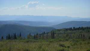
Photo 10 (GPS Location estimated from timestamp)
Photo 11

Photo 12
