Soapstone Creek runs through the Soapstone Basin area of the Uinta-Wasatch-Cache National Forest, tracing packed dirt and rocky two-track between open meadows and stands of aspen and lodgepole pine. The route climbs steadily through the basin before dropping into rougher terrain near its southern end, with a couple of rocky pitches that call for good tire placement.
Trail Summary
- Location: Soapstone Basin, Uinta-Wasatch-Cache National Forest, near Kamas, Utah
- Distance: 7.9 miles
- Difficulty: Level 2
- Minimum Elevation: 7,702 ft
- Maximum Elevation: 9,025 ft
- Elevation Gain: 1,335 ft
- Travel Time: Approximately 35 minutes driving, plus stops
Difficulty
Bridging high clearance 2WD and high clearance 4x4
Stock equipment is generally sufficient, though the terrain will test tire traction and ground clearance in a few spots. Expect dirt and rocky sections with occasional obstacles under 12 inches, including dips, ruts, and short rocky pitches. Most of the route is manageable in dry conditions, but the exposed rock sections toward the southern half are best tackled with 4WD when the surface is wet or loose.
Elevation
The trail climbs from about 7,700 feet near the northern trailhead to just over 9,000 feet at its high point, with total elevation gain around 1,335 feet and loss of about 770 feet. The climbing is gradual overall, broken into a few longer grades rather than one sustained push.
Terrain
Mountain shelf roads and rocky two-track make up most of the route. The trail alternates between smooth, graded sections through open meadow and narrower, rockier stretches shaded by trees. Two short sections of exposed rock require careful line choice, and the road narrows to one vehicle wide in places with turnouts for passing.
4WD Experience
This is a comfortable route for a high clearance 4x4 with room to build confidence. Traction is generally good, and the technical sections are short enough that they do not demand much beyond careful tire placement. Wet weather can soften the dirt and elevate the difficulty of the rockier stretches, so dry conditions are recommended for first-time drivers.
Travel Time
The recorded driving time along Soapstone Creek runs about 35 minutes for the full 7.9 miles. Plan on more time in the field if you stop to explore the meadows, check out dispersed camping spots, or work through the rockier sections at a slower pace. A relaxed half day covers the drive with room to spare.
Highlights
Open meadows near the northern trailhead offer wide views and plenty of dispersed camping. Aspen groves and lodgepole stands provide shade through the middle stretch, and the creek itself runs alongside the road in several places. The rockier terrain near the southern end adds a bit of technical interest before the trail wraps up.
Trail GPS File
Map
GAIA GPS Track
Photos
Photo 1 (GPS Location estimated from timestamp)

Photo 2 (GPS Location estimated from timestamp)

Photo 3 (GPS Location estimated from timestamp)

Photo 4 (GPS Location estimated from timestamp)

Photo 5 (GPS Location estimated from timestamp)
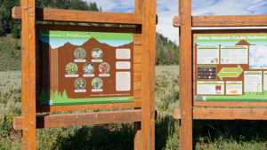
Photo 6 (GPS Location estimated from timestamp)
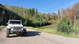
Photo 7 (GPS Location estimated from timestamp)

Photo 8 (GPS Location estimated from timestamp)
