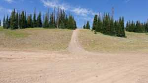
Soapstone Creek runs east from Soapstone Basin through open meadows and stretches of lodgepole and spruce forest, tracing the small drainage it's named for on its way to a junction with Rhodes Canyon. The route sits deep in the Uinta-Wasatch-Cache National Forest above Kamas, and it makes a good half-day drive on its own or as one leg of a longer loop through the basin.
Trail Summary
- Location: Uinta-Wasatch-Cache National Forest, near Kamas, Utah (off Soapstone Basin Road / Forest Road 037, reached from Mirror Lake Highway / UT-150)
- Distance: 5.9 miles
- Difficulty: Level 2
- Minimum Elevation: 8,533 feet
- Maximum Elevation: 9,723 feet
- Elevation Gain: 1,170 feet
- Travel Time: 35 to 45 minutes
Difficulty
Typically suitable for high clearance 2WD
Stock equipment is enough to handle this route, though the surface will test tire traction and ground clearance in a few spots. Expect a dirt and rocky road with occasional obstacles under 9 inches, including embedded rocks, dips, and ruts. Grades can turn steep for short stretches but traction stays reasonable in dry conditions. After rain or snow the road goes unmaintained and can include shallow water crossings and obstacles up to 12 inches, such as small ledges. The road is generally one to two vehicles wide, with pull-outs for passing.
Elevation
The trail climbs from about 8,533 feet near the Soapstone Basin end to 9,723 feet at its high point, a net gain of roughly 1,170 feet with very little elevation lost along the way. Most of the climbing happens gradually rather than in one steep push, though the grade firms up in a couple of shorter sections.
Terrain
Soapstone Creek runs as a narrow, one-lane forest road for most of its length, with pull-outs spaced out to allow oncoming traffic to pass. The surface alternates between packed dirt and sections of loose and embedded rock, and the creek itself stays mostly out of view in the trees except where short side roads drop down to it. A couple of exposed rock sections call for careful tire placement, but neither is long or technical enough to slow the pace much.
4WD Experience
This is an easy, scenic drive for a stock high clearance rig. Four wheel drive is not strictly required in dry conditions but is worth having for the rockier stretches and any water that lingers after storms. The trail stays narrow through most of its run, so a bit of attention to oncoming traffic is worthwhile, especially in the meadow sections near the start where dispersed camping brings more visitors through.
Travel Time
Recorded travel time for the 5.9 mile route was about 35 minutes of driving, with total time on trail closer to 36 minutes including brief stops. Budget 45 minutes to an hour for a relaxed pace with time to enjoy the meadows and take in the views toward Rhodes Canyon.
Highlights
The open meadows near the Soapstone Basin trailhead offer some of the best scenery on the route, with wildflowers common through mid-summer. Further east the trail moves through patches of dense forest before opening up again near its end at the Rhodes Canyon junction, where the terrain hints at the Duchesne River Gorge country beyond. Dispersed camping is plentiful along the western half of the trail for anyone looking to turn the drive into an overnight trip.
Trail GPS File
Map
GAIA GPS Track
Interesting Waypoints
Waypoint 1 (40.54144, -111.02858)
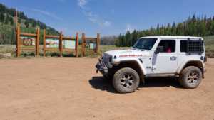
Waypoint 2 (40.54145, -111.02858)
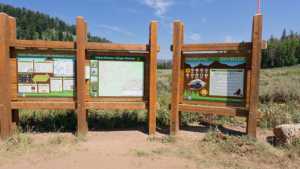
Waypoint 3 (40.55190, -110.97865)
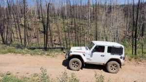
Waypoint 4 (40.55192, -110.97865)
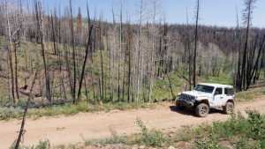
Waypoint 5 (40.55192, -110.97865)
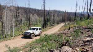
Waypoint 6 (40.54384, -110.93577)
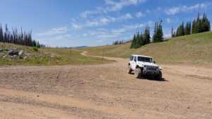
Waypoint 7 (40.54384, -110.93577)
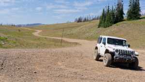
Waypoint 8 (40.54384, -110.93577)
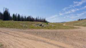
Waypoint 9 (40.54383, -110.93576)
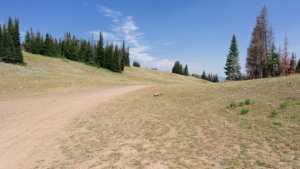
Waypoint 10 (40.54383, -110.93576)