This route climbs out of the timber below Strawberry Peak and works its way up to the summit before dropping north through open meadows and thick stands of aspen. The main line stays within reach of a stock high clearance 4x4, but the spur to the actual peak is steeper and looser, and it's an optional side trip rather than part of the required route. Radio towers mark the top, and the descent north opens into rolling aspen country with several places to camp along the way.
Trail Summary
- Location: Wasatch County, Utah, in the Uinta Mountains near Daniels Summit off US-40, roughly 13 miles east of Heber City
- Distance: 5.05 miles
- Difficulty: Level 3, with an optional Level 5 climb to the Strawberry Peak summit
- Minimum Elevation: 8,948 ft
- Maximum Elevation: 9,716 ft
- Elevation Gain: 252 ft
- Travel Time: 1 hour 13 minutes
Difficulty
Best suited for a high clearance 4x4
Stock vehicles with high ground clearance, 4WD capability, and off-road tires are enough for the main route. Expect a rocky, undulated road surface with obstacles under 12 inches, careful tire placement on the steeper sections, and stretches that are loose underfoot. The road is generally one vehicle wide with places to pass. The spur up to the actual Strawberry Peak summit is optional and steps up to Level 5 terrain, best suited for a lightly modified 4x4 with a small lift and larger tires. Drivers can push to the top on that spur or stay on the easier route below it.
Elevation
The route starts around 9,484 feet, climbs to a high point of 9,716 feet at the Strawberry Peak summit, and then drops steadily north to a low point of 8,948 feet near the end of the track. Total gain over the drive is 252 feet, with 890 feet of loss as the route works its way down out of the peak and into the aspen country below, for a net elevation change of about 638 feet downhill.
Terrain
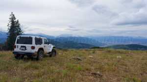
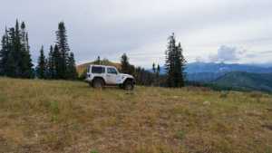
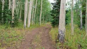
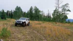
Much of the drive follows mountain shelf roads and rocky two-track as it climbs toward the ridge below Strawberry Peak. Once past the summit spur, the trail narrows and rolls through stands of aspen, some of it new growth only five or six feet tall, mixed with older groves that shade the road in places. Several open flats along the way have been used as campsites, though most sit exposed without much tree cover or privacy.
4WD Experience
Stock high clearance 4x4s should have no trouble with the main line. Tire placement matters on the rockier pitches near the top, and the road narrows enough in spots that meeting oncoming traffic takes some care. The optional summit spur is a different story, with loose, steep sections that reward a lightly modified rig with a bit more clearance and better tires. Drivers not interested in that extra challenge can skip it entirely and continue on the primary route without missing much of the drive.
Travel Time
The recorded track time for this run was 1 hour 13 minutes, including stops, with about 1 hour 3 minutes of that spent actually moving. A high clearance 4WD vehicle covering the same 5 miles, with a stop at the summit and a few photo pulls along the way, should plan on roughly 1.5 to 2 hours depending on how much time is spent at the top and how many of the lower camping spots get checked out along the way.
Highlights
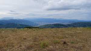
The Strawberry Peak summit is the main draw, with a cluster of radio towers and wide views out over the surrounding ridgelines. Below the peak, the trail passes several campsites tucked into the trees, and the lower half of the route runs through dense aspen groves that would be worth a return trip once the leaves turn in the fall.
Map
Interesting Waypoints
Waypoint 1
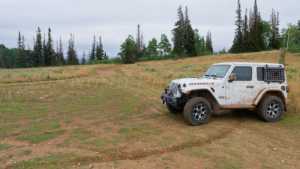
Waypoint 2
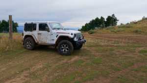
Waypoint 3

Waypoint 4

Waypoint 5 (40.28755, -111.31487)

Waypoint 6 (40.28752, -111.31488)
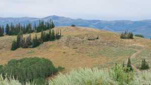
Waypoint 7 (40.28752, -111.31488)

Waypoint 8 (40.28753, -111.31488)

Waypoint 9 (40.28753, -111.31488)

Waypoint 10 (40.28753, -111.31488)

Waypoint 11 (40.28753, -111.31488)

Waypoint 12 (40.28753, -111.31488)

Waypoint 13 (40.28753, -111.31488)

Waypoint 14 (40.28924, -111.31089)
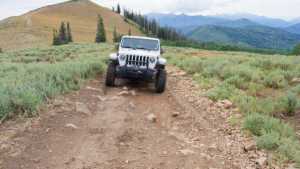
Waypoint 15 (40.29078, -111.31015)
Waypoint 16 (40.29080, -111.31026)

Waypoint 17 (40.29080, -111.31025)
Waypoint 18 (40.29080, -111.31025)
Waypoint 19 (40.29080, -111.31025)

Waypoint 20 (40.32163, -111.29974)
Waypoint 21 (40.32163, -111.29974)

Waypoint 22 (40.32163, -111.29973)

Waypoint 23 (40.32967, -111.30029)

Waypoint 24 (40.32968, -111.30022)
Waypoint 25 (40.33601, -111.30331)

Waypoint 26 (40.33600, -111.30332)

Waypoint 27 (40.33600, -111.30332)

Waypoint 28 (40.33601, -111.30304)

Waypoint 29 (40.33609, -111.30290)

Waypoint 30 (40.33610, -111.30289)
