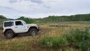
Upper Cedar Hollow OHV climbs into the Uinta Mountains east of Kamas, Utah, following Forest Service route 80178 through dense stands of pine and aspen. It is an out and back trail with embedded rock shelves, a handful of tight spots, and several legitimate camp spots for anyone looking to make a weekend of it. The route tops out near 8,670 feet before rolling down into Cedar Hollow, where it ends abruptly at a posted private property boundary.
Trail Summary
- Location: Kamas, Utah
- Distance: 5.6 miles one way
- Difficulty: Level 3
- Minimum Elevation: 7,665 feet
- Maximum Elevation: 8,672 feet
- Elevation Gain: 392 feet
- Travel Time: 1.5 to 2 hours one way
Difficulty
Best suited for a high clearance 4x4
Stock vehicles with high ground clearance, 4WD capability, and off-road tires handle this trail without much trouble. The surface is mostly rock and undulated dirt, with a few ledges and short climbs that call for careful tire placement. Most of the route runs one vehicle wide with pull-outs to pass oncoming traffic, and low spots can hold mud or standing water for weeks after a rain.
Elevation
The trail starts near 8,180 feet at the trailhead off the Mirror Lake Highway corridor and climbs through the trees to a high point around 8,670 feet roughly a third of the way in. From there the road rolls along a shelf before dropping steadily into Cedar Hollow, ending near 7,665 feet at the private property line. The net change works out to about a 515 foot loss from start to finish, even though the middle section climbs back up before the final descent.
Terrain
This is mountain shelf road and rocky two-track for most of its length, cut through dense pine and aspen. The surface alternates between hard packed dirt, embedded rock shelves, and loose rock sections. A few stretches narrow down to one vehicle wide with rock on one side and a drop on the other. Low areas can hold mud and standing water well after a rain, and the trail is best avoided for a few days following a storm.
4WD Experience
Stock high clearance 4x4s handle most of this trail without much drama. The one section that gets everyone's attention comes about ten minutes in, where a short rocky climb catches out less careful drivers. A bypass runs around that obstacle for anyone who wants to skip it. Beyond that, the challenge is mostly about picking careful lines around embedded rock and staying out of the deeper mud holes. Full size trucks fit the whole way, though the narrower stretches carry some risk of pinstriping.
Travel Time
Plan on 1.5 to 2 hours to cover the 5.6 miles one way, more if you stop to check out the camp spots or the viewpoint near the west end. Round trip out and back adds up to a half day or more with a break at the far end.
Highlights
Several dry camp spots are scattered along the first two miles, including one large enough for multiple rigs. A wide viewpoint opens up near the west end of the trail before it drops into Cedar Hollow. The trail comes to an end at a posted private property boundary, which makes for a natural turnaround point.
Map
Photos
Photo 1 (GPS Location estimated from timestamp) - Trailhead at the start of FS 80178.

Photo 2 (GPS Location estimated from timestamp) - Trailhead at the start of FS 80178.

Photo 3 (GPS Location estimated from timestamp) - Trailhead at the start of FS 80178.

Photo 4 (GPS Location estimated from timestamp) - A large camp spot off to the side of the road, big enough for several rigs.

Photo 5 (GPS Location estimated from timestamp) - A large camp spot off to the side of the road, big enough for several rigs.
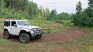
Photo 6 (GPS Location estimated from timestamp) - Approaching the first tricky section of the trail. A bypass runs around it for those who want to skip it.
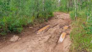
Photo 7 (GPS Location estimated from timestamp) - A nice camp spot along the trail.

Photo 8 (GPS Location estimated from timestamp) - A nice camp spot along the trail.

Photo 9 (GPS Location estimated from timestamp) - A nice camp spot along the trail.

Photo 10 (GPS Location estimated from timestamp) - A nice camp spot along the trail.

Photo 11 (GPS Location estimated from timestamp) - The hardest obstacle on the trail.

Photo 12 (GPS Location estimated from timestamp) - The hardest obstacle on the trail.

Photo 13 (GPS Location estimated from timestamp) - The hardest obstacle on the trail.
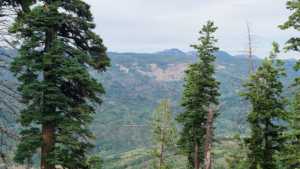
Photo 14 (GPS Location estimated from timestamp) - Mountain shelf road winding through the pines.

Photo 15 (GPS Location estimated from timestamp) - Approaching the overlook near the west end of the trail.

Photo 16 (GPS Location estimated from timestamp) - A wide viewpoint overlooking the surrounding ridgelines.
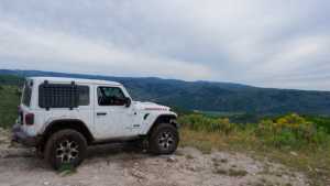
Photo 17 (GPS Location estimated from timestamp) - A wide viewpoint overlooking the surrounding ridgelines.

Photo 18 (GPS Location estimated from timestamp) - A wide viewpoint overlooking the surrounding ridgelines.

Photo 19 (GPS Location estimated from timestamp) - A wide viewpoint overlooking the surrounding ridgelines.

Photo 20 (GPS Location estimated from timestamp) - A wide viewpoint overlooking the surrounding ridgelines.

Photo 21 (GPS Location estimated from timestamp) - The end of the trail, marked by a posted private property boundary.
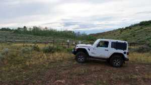
Photo 22 (GPS Location estimated from timestamp) - The end of the trail, marked by a posted private property boundary.